Mount RaYmond
A Quick Hike UP Mt. Raymond from Millcreek Canyon, UT
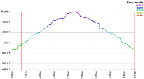
Just before the scrub oak leaves started to change, I was able to get in a quick hike up Mt. Raymond in the Wasatch mountains east of Salt Lake City. Mt Raymond rests on the saddle between Millcreek Canyon to the north, and Big Cottonwood Canyon to the south. The hike was almost 9 miles.
The hike was had some fairly steep sections. Wally (the dog) couldn't make it over the final bump, as it required more scrambling than a dog can do.
Here are some additional photos from the hike:

Looking SSE towards Mt. Raymond from the Terraces trailhead and picnic spot. The Terraces are a great place for a late dinner in the mountains, as they catch the last direct light from the setting sun after the rest of the canyon falls into shade.
On the trail, facing NNW towards Grandeur Peak and the Salt Lake valley behind that.
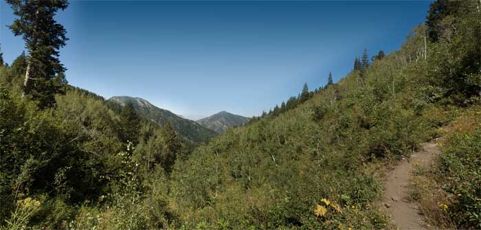
Up higher on the trail, somewhere above Baker Spring (which provided needed water for the dog). In the distance, the Salt Lake valley. We can now see over Grandeur Peak to the north, to Red Butte and City Creek Canyon. To the left, Mount Raymond and the ridgeline above Neff's Spring.
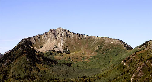
Finally, the saddle between Mt Raymond (center in the image) and Gobblers Knob (right, off camera). The saddle can be seen as the lowest point on the left. This image was taken from a helicopter several days later as part of some aerial photography and mapping that I did. View a gallery of additional aerial photography from the Wasatch mountains and Park City, UT. It is much easier to approach Mt. Raymond from the south via Big Cottonwood Canyon, but the Utah gestapo has decided that mining activities and unnecessary residential construction (and associated sewage) is allowable in the Salt Lake watershed, but dogs are not.